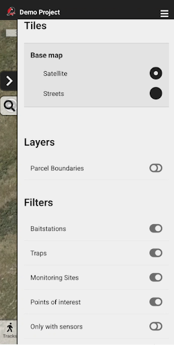
Map features

By default, only the Filters list is shown. This allows you to select which kind of stations are visible on the map.
To enable additional map features visit the General Settings screen.
Base maps
Satellite
Shows photographic satellite images.
Streets
Shows a street map. This must be enabled by selecting Topology in General settings.
Layers
Parcel boundaries
Provides an outline of land, road, and other parcel boundaries, and is especially useful for displaying property boundaries. Enabled by selecting Parcel boundaries in General settings.
Filters
Allows you to adjust the default map view showing traps, bait, monitoring stations, and points of interest.
